Sunrise, Sunset & Moon Times on a Map
July 7, 2026
Knowing when the sun and moon rise and set turns a map into a planning tool. Enter a location and a date and you get the sunrise, solar noon, sunset, moonrise, and moonset in seconds; open the same spot on the map and you can read the sun's angle, the direction a shadow will fall, the moon's phase, and the twilight bands that shape the start and end of the day. This guide covers both, how to get the times and what the light between night and day actually means.
Find the sunrise, sunset, and moon times
The sun and moon analysis tool runs the whole calculation in your browser. There is nothing to install and no file to upload.
- Pick the date you are planning for.
- Enter a decimal latitude and longitude, or press Use my location to fill them from your device.
- Read the sunrise, solar noon, sunset, and day length, plus moonrise and moonset.
Times are shown in your device's local time zone, in 24-hour format. Some days show no moonrise or no moonset: because the moon rises roughly 50 minutes later each day, a rise or set occasionally slips past midnight and lands on the next date.
What twilight actually means
Sunrise and sunset are single moments, but the light does not switch on and off. Twilight is the transition, and it is defined by how far the sun sits below the horizon. There are three stages, each darker than the last.
| Stage | Sun below horizon | What it looks like |
|---|---|---|
| Daylight | above the horizon | Full daytime light. |
| Civil twilight | 0° to 6° | Bright enough for most outdoor activity without a light. |
| Nautical twilight | 6° to 12° | The horizon is still faintly visible; brighter stars are out. |
| Astronomical twilight | 12° to 18° | Sky essentially dark to the eye. |
| Night | below 18° | Full darkness. |
Two points on that ladder have their own shorthand. BMNT is begin morning nautical twilight, the morning moment the sun reaches 12 degrees below the horizon and the sky first shows usable light. EENT is end evening nautical twilight, the evening mirror image, when the sun drops back to 12 degrees below and the last natural light is gone. Between BMNT and EENT you have working light of some kind; outside them it is night.
See the angles and twilight on the map
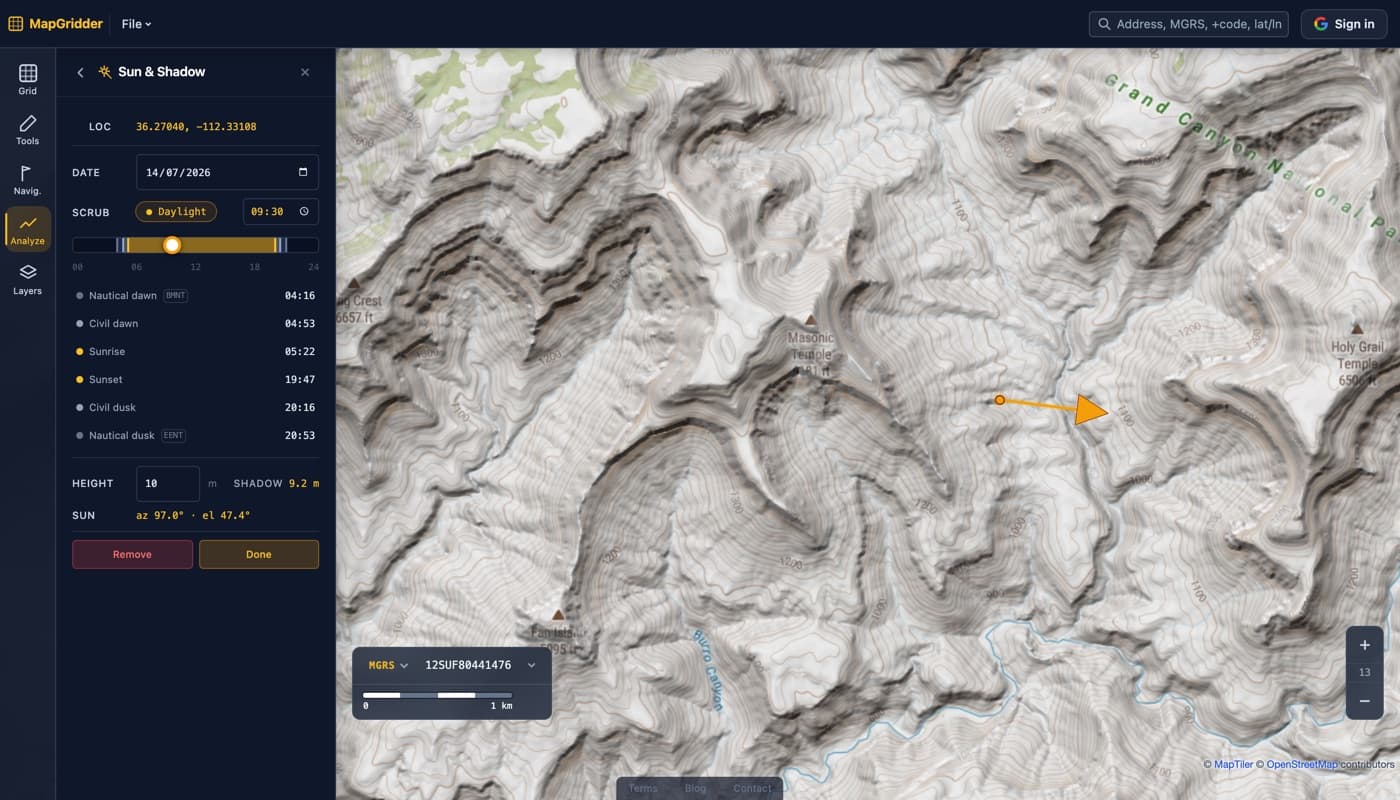
The times tell you when. The map tells you where the light comes from and how much of it you get. Open the sun analysis tool and drop a marker to read the sun's azimuth (its compass bearing) and altitude at any minute, with a shadow arrow for an object of a height you set. Scrub the time of day and the shadow swings around, so you can see exactly where a building, ridge, or tree line will cast shade. The day-band scrubber marks civil and nautical twilight (including BMNT and EENT) along the day, so first and last light are one glance away.
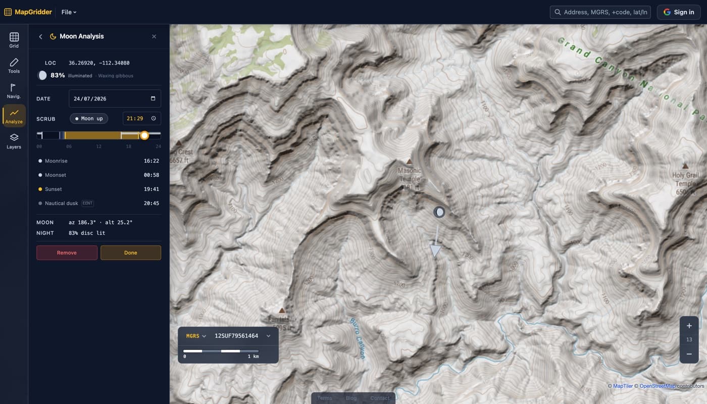
Switch to moon analysis to place a moon marker that shows the current phase and percent illumination, its azimuth and altitude, and a moon-up lane on the same scrubber. Under a bright, high moon you can move at night with little else. Near a new moon the ground stays dark even when the moon is up. Reading phase and altitude together tells you which night you are going to get.
A quick planning workflow
- Get the sunrise, sunset, and moon times for your date on the tool page.
- Open the location on the map and check the shadow direction at the hour you care about.
- Note BMNT and EENT from the day-band scrubber for your first-light and last-light windows.
- Add moon phase and altitude if you are planning after dark, then mark the plan with waypoints or a grid.
Ready to plan around the light? Start with the sun and moon analysis tool for the times, then open sun analysis on the map for the angles and twilight.