What Is a Plus Code and How to Read One
July 14, 2026
A Plus Code is a short code like 8FVC9G8F+6X that names a small rectangle of the Earth, about 14 meters across. The system behind it (Open Location Code) has one rule applied over and over: divide the world into 20×20 cells, name each cell with two digits, and repeat inside the cell you picked. Four pairs and a final refinement later, you have addressed a doorway. No streets, no building numbers, no database; just math.
That is why Plus Codes have become the de facto digital address in places where formal addressing is thin: a code names a home in an unnumbered settlement exactly as reliably as it names an office in Zurich. You have probably seen one in your map app without noticing; the string with the + in a place’s details is a Plus Code.
The anatomy of a Plus Code
A full code has five digit pairs, coarse to fine. Take 8FVC9G8F+6X, a cell in Zurich:
Stop at any pair: 8FVC0000+ is the 1° area, 8FVC9G8F+ the 275 m block. Zeros pad the gap up to the plus sign.
The digits come from a deliberate 20-character alphabet, 23456789CFGHJMPQRVWX. No vowels, so codes cannot spell words; no 0/O or 1/I/L, so nothing is misread over a phone. The + after the eighth digit carries no data at all; it is there so a code is recognizable as a code, the way @ marks an email address.
How the code zooms in (try it)
The easiest way to internalize the pairs is to walk one code down. This starts at 8F, the 20° region covering the Alps, and each click picks one of the 400 sub-cells:
What the Plus Code grid looks like on a map
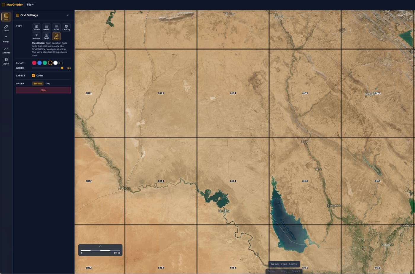
Because every level is a plain slice of latitude and longitude, the grid draws as clean squares that subdivide as you zoom. At a regional zoom each cell shows its significant digits:
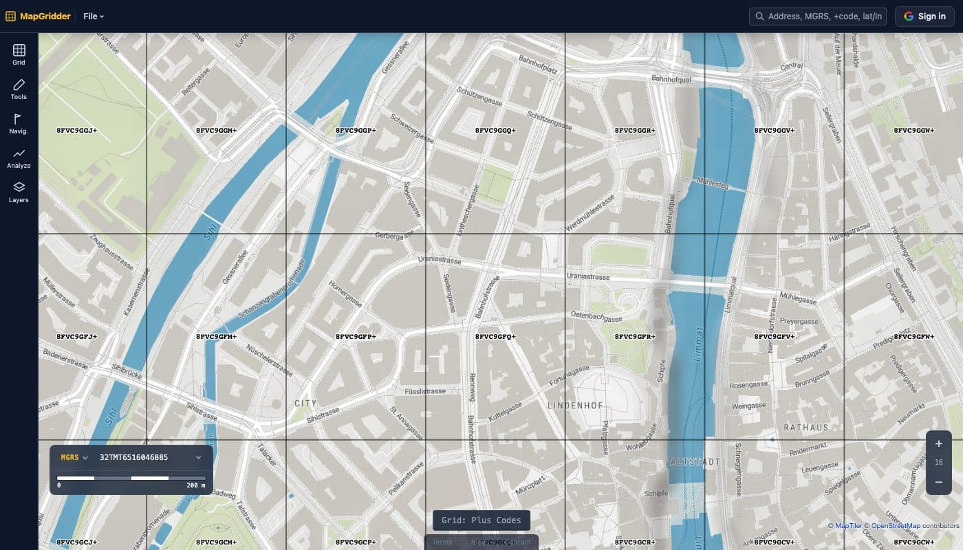
Zoom in and the grid keeps up: each square splits 20×20, the label simply growing two digits at each step until full codes appear:
Short codes: the form you actually see
Map apps rarely show all ten digits. The leading pairs name a region and an area, and if you already know roughly where you are they are redundant. So codes get shared short: 9G8F+6X Zurich means “find Zurich, then resolve 9G8F+6X to the nearest matching cell.” The town name replaces four digits. Paste either form into the MapGridder search bar: full codes fly straight to the cell, bare short codes resolve near your current map view, and a short code with a place name is looked up against that place.
Plus Codes vs MGRS
Both systems turn a location into one string you can read over a radio or paste in a chat, and both are worldwide. They optimize for different jobs: Plus Codes answer “where do I send this?”, MGRS answers “where exactly is that?”
| Plus Codes | MGRS | |
|---|---|---|
| Built on | Plain 20×20 degree slices | UTM zones and metric squares |
| Finest unit | About 14 m (3 m with an 11th digit) | 1 m square |
| Example | 8FVC9G8F+6X | 32TMT 6540 4715 |
| Shortening | Built in (9G8F+6X Zurich) | Truncate digits (lower precision) |
| Cell shape | Angular squares (narrow near poles) | True metric squares (within a zone) |
| Typical job | Everyday addressing, deliveries, sharing places | Military and SAR point reporting |
The structural difference is the zones. MGRS inherits UTM’s 6° slices, which buy true metric distances at the cost of seams; Plus Codes have no seams anywhere, which buys simplicity at the cost of cells that narrow toward the poles and never reach single-meter precision. They are complements: share the meetup point as a Plus Code, report the casualty location in MGRS.
Where Plus Codes come from
Plus Codes are the consumer name for the Open Location Code standard, developed at Google in 2014 and published as an open, Apache-licensed specification anyone may implement. Google’s own Plus Codes site documents the format and its use in municipal addressing programs across Africa and India, where codes serve as official addresses for homes that never had one.
See the grid on a live map
The fastest way to build intuition is to watch the grid subdivide over terrain you know. Open the map, pick Plus Codes in the Grid panel, and zoom; the labels grow two digits at every level, exactly like the explorer above. Searching a code like 8FVC9G8F+6X flies straight to its cell.
Have coordinates to convert? The lat/long to Plus Code converter gives you the code at three detail levels, and decodes full or short codes back. For the metric-grid side of the story, read MGRS vs UTM vs lat/long.