What Is GARS and How It Differs from MGRS
July 13, 2026
GARS, the Global Area Reference System, names areas with short codes like 380MK. The world is sliced into 30-minute cells; each cell splits into four 15-minute quadrants and each quadrant into nine 5-minute keypads, so 380MK17 pins down a rectangle about 9 km across. It exists so that pilots, ground teams, and planners can all say the same thing about the same patch of the map in seven characters or fewer.
That is the fundamental contrast with MGRS: an MGRS reference names a point (down to a single meter), while a GARS reference names a box. If you have ever coordinated a search sector, deconflicted airspace, or assigned an area to a team, you were doing the job GARS was designed for.
The anatomy of a GARS reference
A full reference has four parts, coarse to fine. Take 380MK17, a keypad in the Swiss Alps:
Stop at any point: 380MK is a cell, 380MK1 a quadrant, 380MK17 a keypad.
The numbering is fixed and worldwide. Band 001 starts at 180°W and the numbers count eastward, two per degree, up to 720. The letters start at AA on the Antarctic edge and climb to QZ near the North Pole, skipping I and O so nothing reads as a 1 or 0 over a radio.
How a cell subdivides (try it)
The easiest way to internalize quadrants and keypads is to click through one cell. This is 380MK, the 30-minute cell over the Alps used in the screenshots below:
What GARS looks like on a map
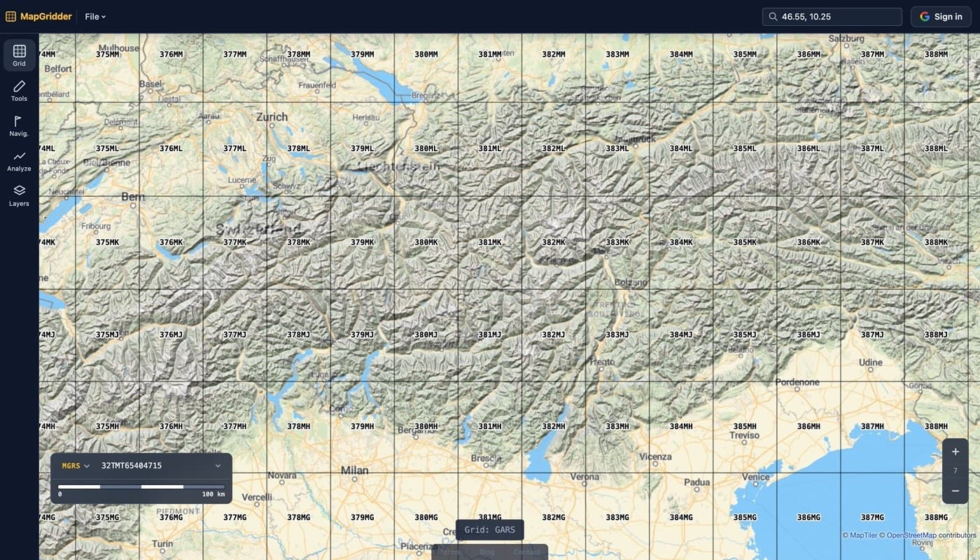
Zoomed out, the grid is the plain 30-minute lattice; every cell carries its five character name:
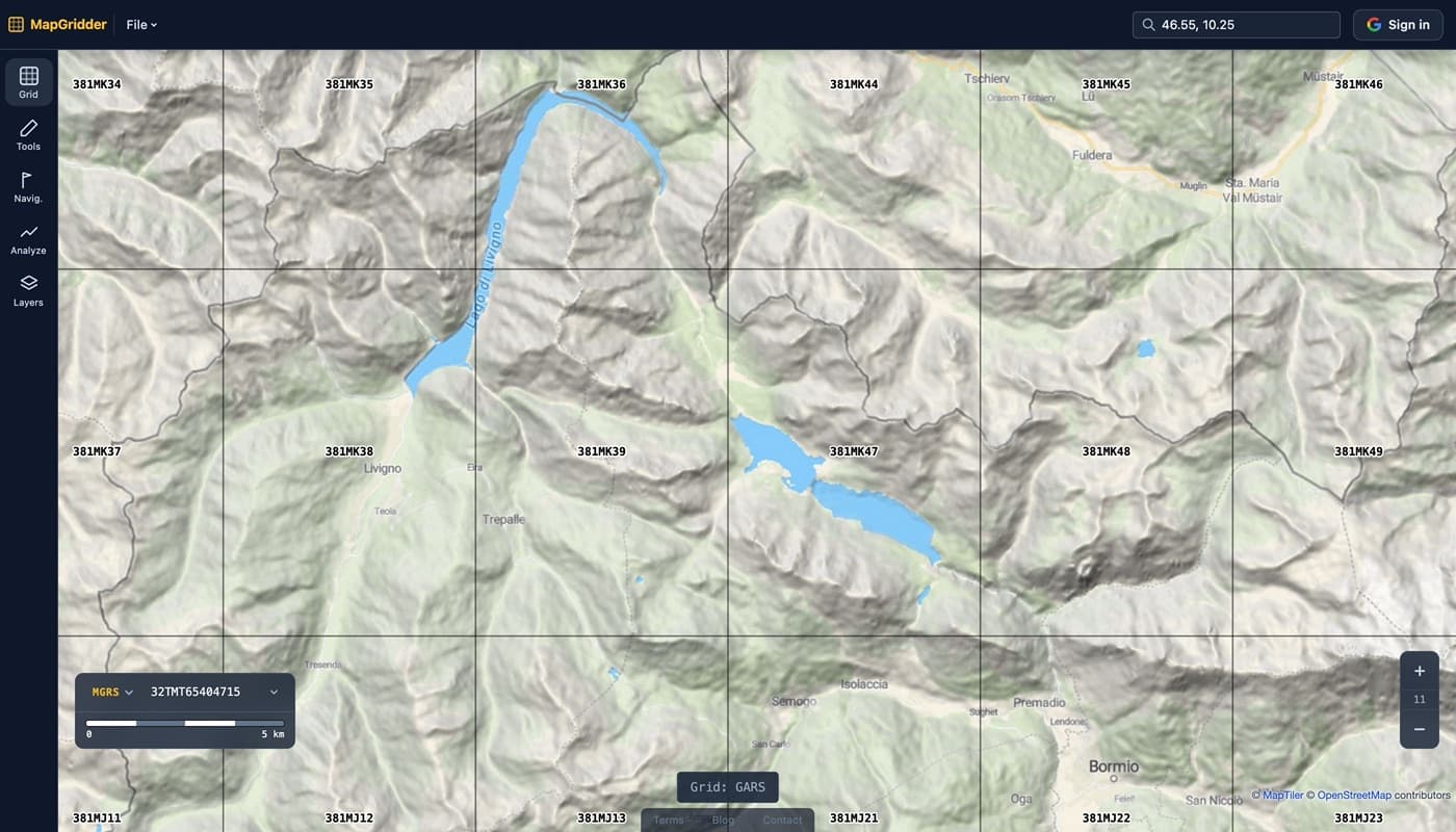
Zoom in and the grid keeps up: cells split into quadrants (381MK1), then into keypads (381MK47), the reference simply growing a digit at each step:
GARS vs MGRS
Both systems are worldwide, both compress a location into one string, and both come from the same defense world. They answer different questions: GARS answers “which box?”, MGRS answers “which spot?”
| GARS | MGRS | |
|---|---|---|
| Names | An area (cell, quadrant, keypad) | A point (down to 1 m) |
| Built on | Plain latitude/longitude slices | UTM zones and metric squares |
| Finest unit | 5′ keypad, about 9 km | 1 m square |
| Example | 380MK17 | 32TMT 6540 4715 |
| Cell shape | Angular rectangles (narrow near poles) | True metric squares (within a zone) |
| Typical job | Assigning and deconflicting areas, air-ground coordination | Reporting and finding exact positions |
The structural difference matters in practice. MGRS inherits UTM’s 6° zones, so two points on opposite sides of a zone boundary get references that look unrelated, and grid squares get clipped at the seams. GARS has no zones at all: the same simple rule covers the planet, which is why it works well as a shared bookkeeping grid. The price is precision; a GARS keypad is a 9 km box, useless for pointing at a building. The two systems are complements, not competitors: brief the area in GARS, report the position in MGRS.
See both grids on a live map
The fastest way to build intuition is to flip between the two grids over terrain you know. Open the map, pick GARS or MGRS in the Grid panel, and watch how each one divides the same mountains. Searching for a reference like 380MK17 flies straight to that cell.
Have coordinates to convert? The lat/long to GARS converter gives you the cell, quadrant, and keypad in one shot. For the point-precision side of the story, read how to read a military grid reference.