Open and Edit a Geospatial PDF (GeoPDF) Online
Got a US Topo quad, an incident map, or any georeferenced PDF? Open it on a live map in your browser, work on it, and export it back out.
September 1, 2026
Have the file already? Open the map with the importer ready.
Until now, opening a GeoPDF meant installing something
Every existing answer to "open a GeoPDF" is an installed app: Avenza Maps on a phone, QGIS or GDAL on a desktop. All fine tools, and none of them a browser tab.
MapGridder now opens these files directly in the browser: sign in, import the file, and the map lands georeferenced on a live basemap. For the desk half of the job, planning, studying and annotating, it is a browser-native alternative to Avenza Maps.
Yes, geospatial PDFs really render online here
USGS US Topo quads, the entire Historical Topographic Map Collection, Forest Service and BLM maps, state raster archives, GIS exports and purchased offline maps: they all load right here, georeferenced on a live basemap. Import several and each is its own overlay; two adjacent quads join into one continuous map.
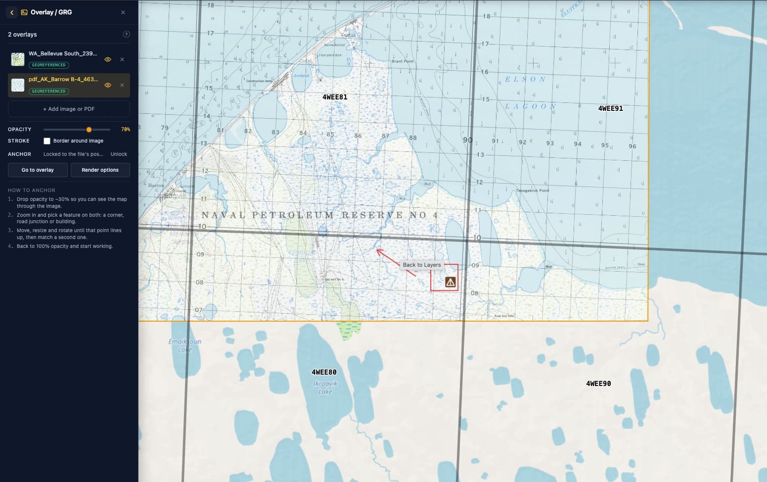
You choose what renders
- The page. Multi-page files show every page up front; pick the one you need.
- The file's own layers. Published quads carry orthoimage, roads, woodland tint and more as separate layers. Turn them on or off before anything renders, and re-render later with a different mix without picking the file again.
- The collar. Trim to the map area for a clean overlay, or keep the full page with its legend and scale bars.
Then edit it like any other map
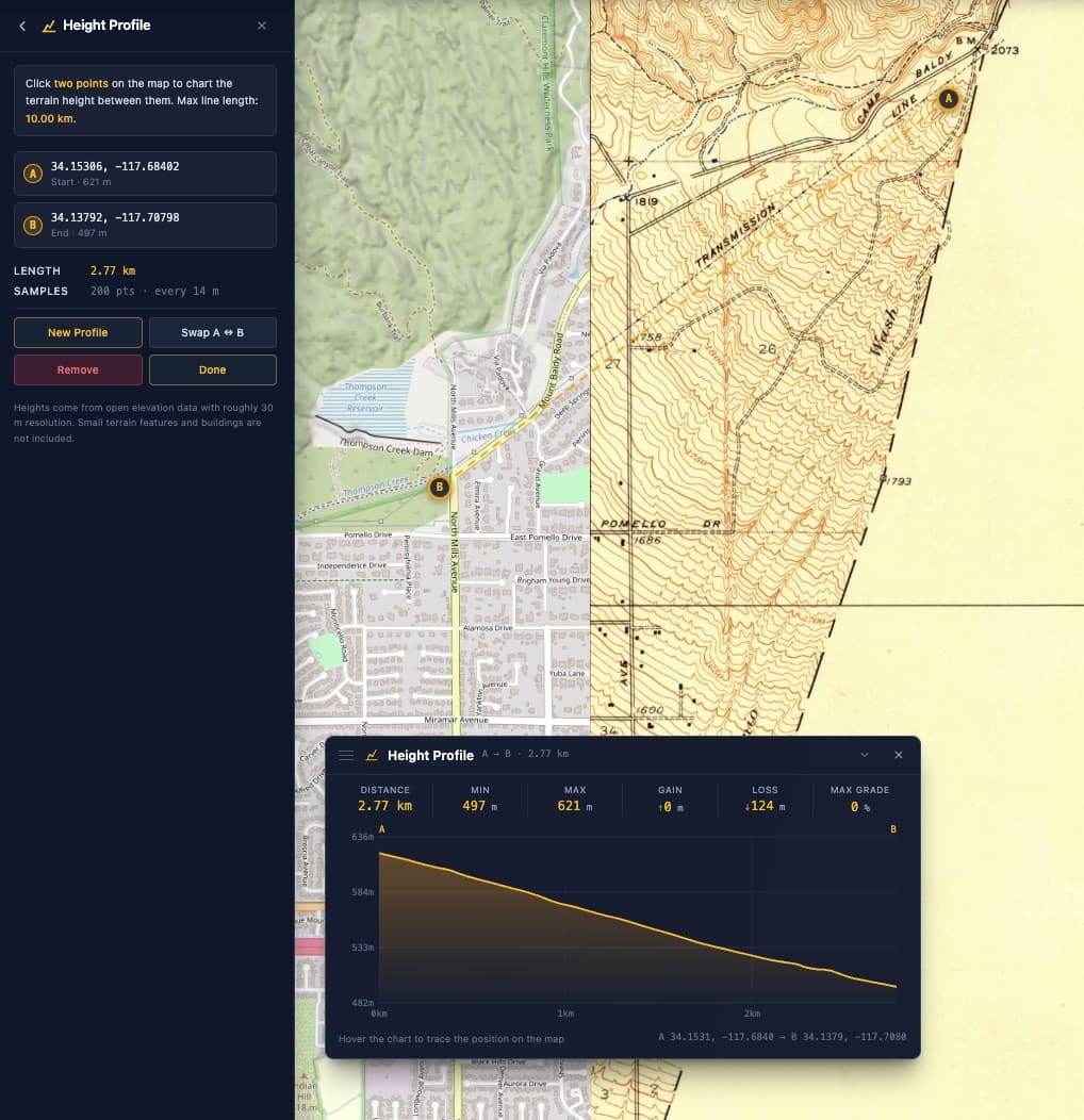
Once the sheet is down, the whole toolbox works on top of it: an MGRS, UTM or custom grid, routes, painted sectors, tactical, topographic and SAR symbols, distance measurements, sun and moon analysis. And it round-trips: export the annotated result as a fresh geospatial PDF and hand it to the field.
A PDF with no coordinates still works: it lands centered on your view and you drag its corners onto the real world, the same hand-anchoring any reference image gets.
Open one, step by step
- Open the map and sign in. Importing asks for a free account.
- Import the PDF. Pick it from the File menu's Import, or add it straight from the Overlay panel.
- Choose page, layers and detail, then import. The map stays usable while the sheet renders, and it lands locked in its true position.
- Work on it. Grid it, draw on it, measure on it. Export when the plan is ready.
Desk here, field there
A browser is the wrong place to follow your own blue dot up a ridge; phones give a field app better positioning than any web page gets. The workflow that plays to both strengths: open and study the sheet here, plan on it with real tools, then export the result and navigate with it in the offline app you already trust.
Where to get files, and where to read more
- The USGS National Map. The program behind the US Topo quads and the historical topographic collection; both series are free downloads and both open here.
- Utah's raster archive. A state-level example of the same idea: georeferenced topo sheets and imagery served as direct downloads.
- The Army Geospatial Center's GeoPDF fact sheet. A short official explainer of what the format is and why the military standardized on it.
- Utah GIS on GeoPDFs. A practitioner's introduction from a state GIS office, written for people who just want to use the files.
FAQ
Can I open a GeoPDF in my browser?
Yes. Sign in, import the file, and the map lands georeferenced on a live basemap in the browser tab. There is nothing to install and no app store involved. Open the map and try it.
Which geospatial PDFs work?
Files that carry the geospatial extension of the PDF standard: USGS US Topo quads, Forest Service and BLM maps, GIS exports, purchased offline maps, and the files MapGridder itself exports. Older maps in the legacy TerraGo encoding place automatically too, including the USGS Historical Topographic Map Collection; the rare file we cannot read still opens and you place it by hand. How the export side works.
Does my PDF get uploaded to a server?
By default, no: the file is opened and drawn entirely on your device. Paid plans can choose to back a map up to their account so it lands on their other devices too; that upload only ever happens by choice.
Can I export it to my favorite offline phone app?
Yes: study and prepare the map here, then export a geospatial PDF and navigate with it in your offline app of choice.
The test takes two minutes: grab any free US Topo quad, open the map, and import it. If it does not land exactly where the mountain actually is, tell us.