Export a Geospatial PDF (GeoPDF) Online
Need a map file for Avenza Maps, another offline app, or any tool that reads georeferenced PDFs? This is how you make one.
August 31, 2026
In this post
- What a geospatial PDF (GeoPDF) is: an ordinary page that also knows where it sits on Earth.
- Why it became the file format of the field, and who already lives on it.
- The whole idea in one line: prepare the map here, take it to your favorite app.
- The export itself, on a desktop or on a phone, then the file on your device.
- What the format will not do for you, stated before you find out at a trailhead.
A PDF that knows where it is
Open a normal map PDF on a phone and you have a picture. Maybe a very good picture. It has no idea where you are standing, and neither does the phone as far as that page is concerned.
A geospatial PDF is the same page with the map's coordinates written into it. Every point on the page ties to a point on the ground. Software that reads those coordinates can then do the one thing that matters once the boots are on: put your GPS position on the page and slide it along as you walk.
Why this format won the field
Think about what else you could carry into a valley with no bars.
One file. No account to create on the other end, no tile cache to warm up, no coverage to pray for. That is the entire reason agencies that cannot afford a bad map day standardized on it.
Who already lives on it
- USGS topo quads. The modern US Topo series is published as GeoPDF, the direct descendant of the paper 7.5 minute quad that lived in a map case for fifty years.
- Wildland fire. Incident maps go out to the line as PDF map packages, and crews load them on phones at briefing.
- Search and rescue. A team gets the segment it owns as a page, with the same references everyone hears on the radio.
- Hunters. Unit boundaries, public and private land, access roads, bought or grabbed free from an offline map store before the truck leaves pavement.
- Milsim and training. One gridded objective map, briefed once, carried by everyone, readable by the guy whose phone has no data plan.
Prepare the map here, navigate with it there
Planning is a desk job, so do it on a desk: an MGRS grid or a custom metric grid at the spacing your team briefs on, waypoints and objectives, the route, tactical, topographic or SAR symbols, sectors, and a reference image or GRG underneath when the paper product matters more than the basemap.
Then you export one page and open it in the offline app you already trust. Your position rides on your map: your grid, your labels, your objective numbering, your colors. Not a generic basemap with a pin dropped on it and a screenshot in your camera roll for reference.
Export it, on a desktop
- Build the map first. Grid on, symbols placed, route drawn. What you see is what the page gets.
- Open the File menu and choose Export as Geospatial PDF.
- Frame the ground you want. Drag the frame on the map, pull a corner to resize, pan underneath to line it up. Everything inside becomes the page.
- Choose the detail level. Standard keeps the file phone friendly. High trades file size for a sharper page, which is what you want when you plan to zoom in hard on a small area.
- Sign in if you have not. Exporting is the one thing that asks for a free account. Your framing and your detail choice wait for you and come back exactly as you left them.
- Export. The page downloads to your device.
Export it, on a phone
Same file, two steps. Frame the area full screen and confirm the framing, then choose the detail level and export. Useful when the plan changed in the parking lot and the laptop is three hours away.
Get it onto the phone
Move the file over however you normally move files: AirDrop, a cloud folder, a cable, an email to yourself. In Avenza Maps or another offline map app, import it the way you would import any map, and the page appears in your map list. Open it, and your position shows on it. Do this at the kitchen table, not at the trailhead, and do it while you still have a connection, because importing a file you never downloaded is a classic way to start a day badly.
What rides along in the file
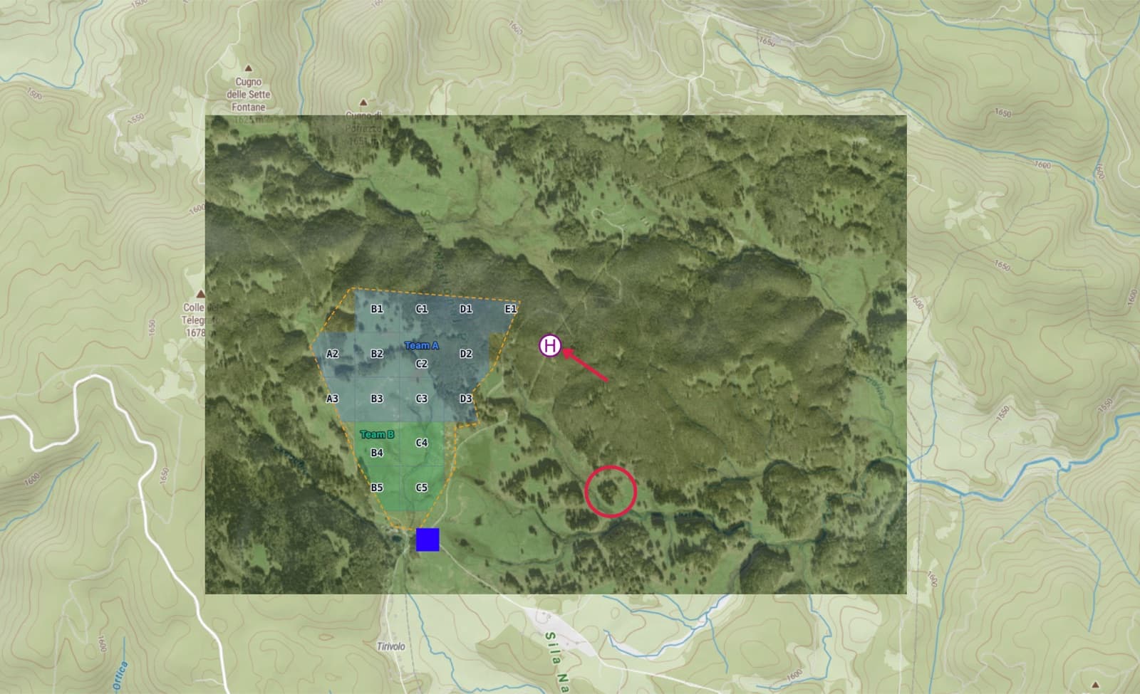
Everything visible on the map when you export: the MGRS or USNG grid, a custom metric grid with its row and column labels, waypoints and objectives, routes and imported tracks, tactical, topographic and SAR symbols, radius rings, painted sectors, distance measurements, and any reference imagery underneath. The page comes out north up, which is how field maps are read and argued over.
Straight talk about what it is not
- It is a picture with coordinates, not a data file. Symbols and routes do not arrive on the other end as editable objects. When you need data rather than a map, export GeoJSON, GPX or KML instead, or send both.
- Detail is fixed at export. Pinching in on the phone magnifies pixels; it does not go fetch a sharper map. Frame tight around the ground you will actually cover.
- Paper is still a good idea. Batteries die at the worst possible moment. A printed PDF at true scale is the backup that never needs charging.
FAQ
What is a GeoPDF?
A geospatial PDF is an ordinary PDF page that also carries the coordinates of the map printed on it, so software can tie any point on the page to a point on the ground. GeoPDF is TerraGo's trademark and the term most people search for. The open equivalent is the geospatial extension built into the PDF standard itself, which is what US Topo quads use and what Avenza Maps, QGIS, and GDAL read.
Can I make a GeoPDF online without installing software?
Yes. There is nothing to install and no app store involved: the whole tool runs in your browser, from building the map to downloading the finished geospatial PDF. Open the map and try it.
Will the exported file open in Avenza Maps?
Yes. MapGridder writes the open geospatial extension of the PDF standard, the same flavor the USGS ships its topo quads in, so it imports like any other map file. Desktop GIS reads the same file, and so do the other offline map apps that support georeferenced PDFs.
Do I need a signal in the field?
No. Once the file is on the phone the map is the file, not a stream of tiles, and GPS positioning needs no network at all. Airplane mode, dead zone, foreign SIM: your position still moves across the page.
Do my grid and my symbols come along?
Yes. Whatever is visible on the map at the moment you export goes onto the page: the MGRS or USNG grid, a custom metric grid, waypoints, routes, imported tracks, tactical, topographic and SAR symbols, radius rings, sectors, and any reference imagery you placed underneath.
The honest test is your next trip. Open the map, build the thing you would have drawn on a printout anyway, and pick File then Export as Geospatial PDF. If your position does not land on your own grid the first time you open it in the field, tell us where it went wrong.