What Can I See From Here? Viewshed Map Online
November 9, 2026
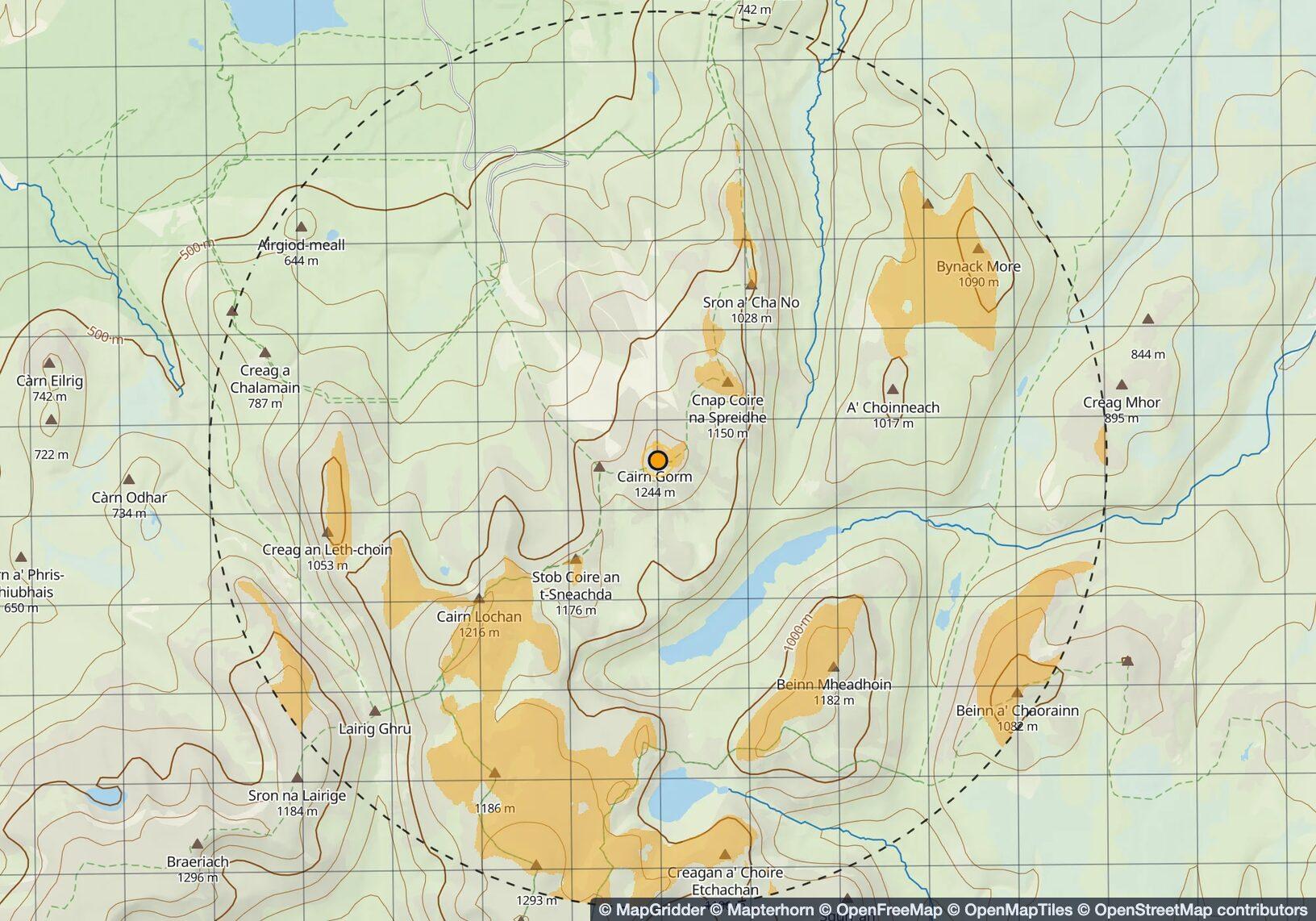
Press a point on the map and the ground it overlooks turns amber. Everything else is hidden behind a ridge, a shoulder or the curve of the earth. That is a viewshed. It used to be a job for the GIS desk and a Tuesday. Now it is one press in your browser, on a topo or satellite map, with your grid already on it.
What a viewshed analysis is for
- Observation posts and patrol bases: cover the approaches, then find the dead ground an approach would use.
- Search and rescue: where a spotter on the ridge can see into the drainage, and which sectors need boots instead of binoculars.
- Radio: whether a repeater on the knoll has terrain line of sight to the camps. First filter, not a propagation model.
- Hunting: which spot overlooks the benches you care about, before you climb to it in the dark.
- Summits and campsites: whether the tent sees the sunrise peak, or just the hill in front of it.
Viewshed analysis in the wild
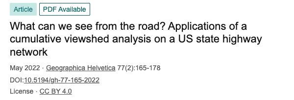
Other people take this further than we do. A geographer at Central Washington University ran a cumulative viewshed of an entire state highway network to answer a question nobody had asked out loud: what can we see from the road? Peer reviewed, open access, fourteen pages. Now we know.
- A land trust bought 850 acres because they sit inside the view from McAfee Knob on the Appalachian Trail. A viewshed with a budget.
- One account on X with strong views on rim analysis. We read the whole thread.
Jokes aside. The same maths decides where an observation post goes and which approach is dead ground, where a spotter sits above a search area, which repeater reaches camp, and whether the tent sees the sunrise. Operators, SAR teams, hunters and hikers have paid for this answer in boot leather for a long time. Now it is one press.
How to make a viewshed map online
Open the Viewshed tool in the Analysis group and press where you would stand. The ground you can see from there paints within a few seconds, out to the radius you set. Drag the observer and the picture follows live, so you can walk a ridge with your finger and watch the dead ground open and close. Set the observer height for a person, a mast or a tower, and the target height for what you are looking for: a standing person, a vehicle, a tent.
Add more observers, each in its own colour. Where two colours overlap, two posts see the same ground. Where none paints, nobody does. That gap is the useful part.
What a viewshed does not show
Terrain, and only terrain. The elevation data has no trees, buildings, hedgerows, standing crops, snow banks or parked trucks, and it smooths over anything smaller than a cell: a wadi a few metres deep, a berm, a quarry face, a fresh cut through a forest. Painted means the ground allows the view. Whether you get it is a question for your binoculars.
Line of sight map between two points
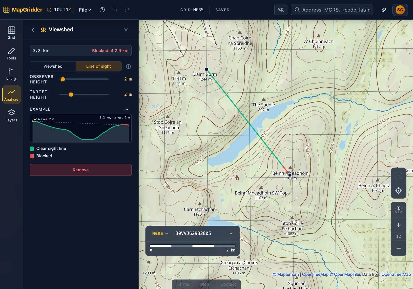
Line of sight is its own analysis, not a side effect of the viewshed. Two presses, where you are and what you need to see, and that pair gets the full treatment: clear or blocked, the point where the ground cuts the line, the distance to it, and the terrain profile between the two. Enough to decide between moving ten metres and finding another hill.
Reach matches the viewshed radius, up to 30 km / 20 mi, with the earth's curve and refraction already in the sum. Past that the air does more to the view than the terrain does.
Try the viewshed tool
- Open the Viewshed tool and press where you would stand.
- Set the heights and the radius.
- Drag the observer along the ridge and watch the dead ground move.
- Switch to Line of sight and press two points.
Everything runs in your browser. Nothing to install, nothing to update, nobody to wait for.
Common questions
What is a viewshed?
The ground visible from one point, given the terrain: everything a straight line from the observer's eye reaches without hitting a hill first. Trees and buildings are not in it.
How accurate is the viewshed?
The terrain is public elevation data at 10 to 30 m, depending on the country. Enough to tell a ridge from a valley and to find the dead ground under a summit. Not enough to show a wall, a hedge or a shallow dip. Plan with it, then check the spot on the ground.
How far can a viewshed reach?
Up to 30 km / 20 mi from the observer, with the earth's curvature and refraction accounted for.
Can I check line of sight between two points?
Yes. Pick Line of sight, press the observer and then the target. The line tells you whether the view is clear and, if not, how far out it is blocked.
Does it work on a phone?
Yes. Same tool, in the phone's browser. Press the map, drag the observer, read the result. No app.