Weather Planning on a Map: Hiking, Tactical, Navigation
July 20, 2026
Everybody has a weather app. The problem is that your weather lives in one app and your plan lives on another map: the grid you brief from, the route you drew, the waypoints and symbols that mark what matters. Reading "rain at 21:00" off a phone tells you nothing about which leg of the route gets wet or which grid square the cell is sitting over. MapGridder now draws live weather radar and forecast layers on the same map as your MGRS grid, GPX routes, and tactical symbols, which is where weather actually becomes a planning input.
Three weather layers, one time scrubber
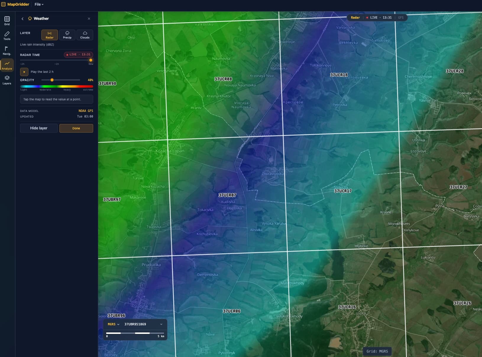
- Radar: live rain intensity in dBZ, scrubbing the last two hours up to a LIVE now frame, so you see where it is raining and which way the cells moved.
- Precipitation: forecast rain and snow intensity from now to 48 hours ahead.
- Cloud cover: cloud density for the next 24 hours, useful alongside the sun and moon tools for visibility planning.
Tap anywhere and you get the value at that point for the scrubbed time: rain rate in mm/h (or in/h if your units are imperial), radar reflectivity in dBZ, or cloud density. The data comes from the NOAA GFS forecast model.
Weather by grid square
With an MGRS grid overlay under the radar, weather stops being a vague blob and becomes a reference you can transmit: the cell is over a specific 1 km square, moving toward the squares your objective sits in. Everyone on the same grid reads the same picture, whether they are looking at MapGridder, a paper map, or a GPS set to MGRS. The same works with UTM, or a custom metric grid if that is what your team briefs from. Right-click any point to copy its full coordinate set alongside the weather readout.
Scrub the forecast along your route
Draw the route or import the GPX, switch to the precipitation layer, and scrub the next 48 hours. Identify when the rain band crosses each leg, then set the departure time that keeps the exposed legs clear. Waypoints, objective markers, and tactical symbols render above the weather field, so the full picture stays on one screen: the route, what is on it, and the conditions at each timeframe.
For night work, pair the cloud layer with moon analysis: a bright moon under overcast is a dark night anyway. Cloud density for the next 24 hours next to moonrise, phase, and altitude answers that in one view.
Weather in military op planning
Weather is a planning factor, not a footnote: visibility, illumination, and trafficability all move with it. Build the operations picture in one place: unit symbols and tactical drawings over the objective, radar and the 48 hour precipitation window over the same MGRS references the order uses. Time each phase against the forecast, run the cloud layer next to moon illumination for the night phase, and read the conditions at the objective grid at H-hour instead of a regional forecast. Every element briefs off the same squares.
A weather-aware planning workflow
- Open the weather layers on the map and check live radar: what is falling right now, and which way is it moving?
- Turn on your grid (MGRS, UTM, or custom) so the weather picture uses the same references as your plan.
- Draw or import the route, drop waypoints and symbols, and scrub the precipitation forecast across your departure window.
- Tap the readout along the route legs that worry you, pick the dry window, and note the times.
- Export the map or brief straight off the screen; the weather layer renders into captures and exports like every other layer.
Ready to see the sky over your plan? Open weather on the map, add your grid, and scrub the next 48 hours before you commit to a departure time.